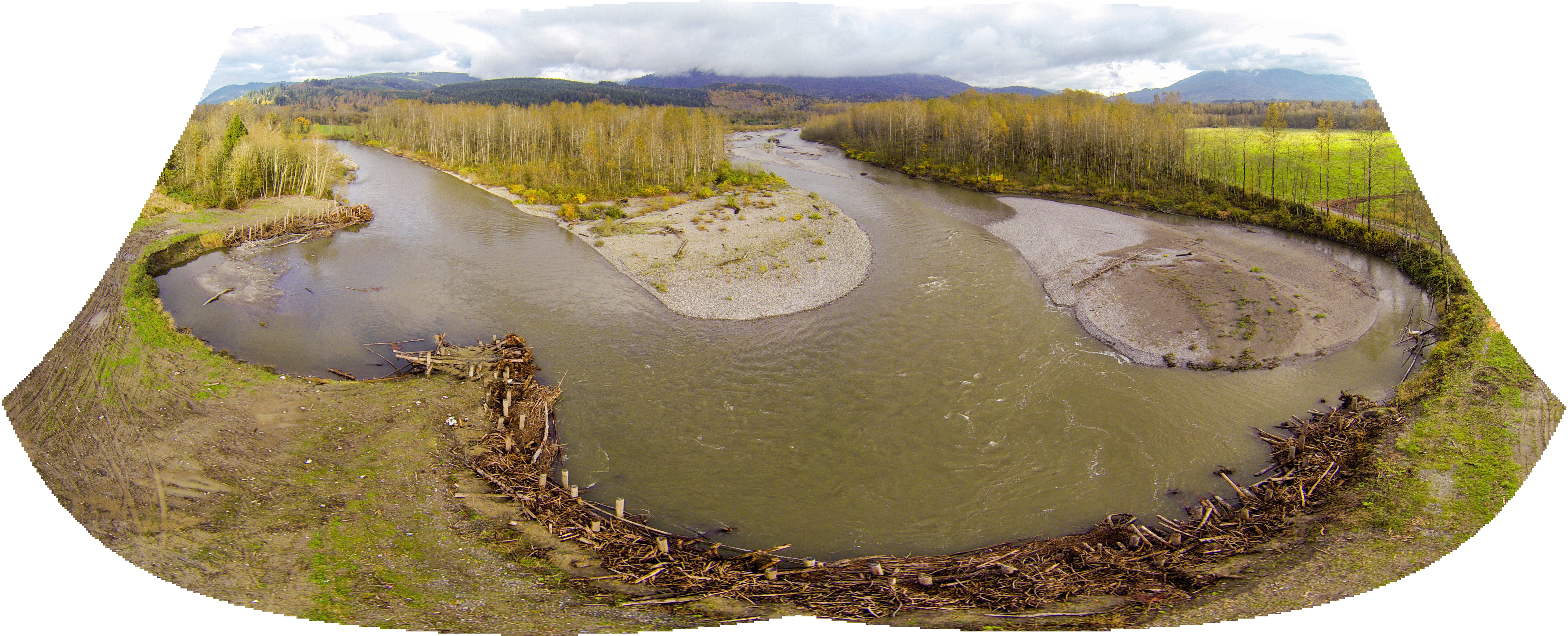
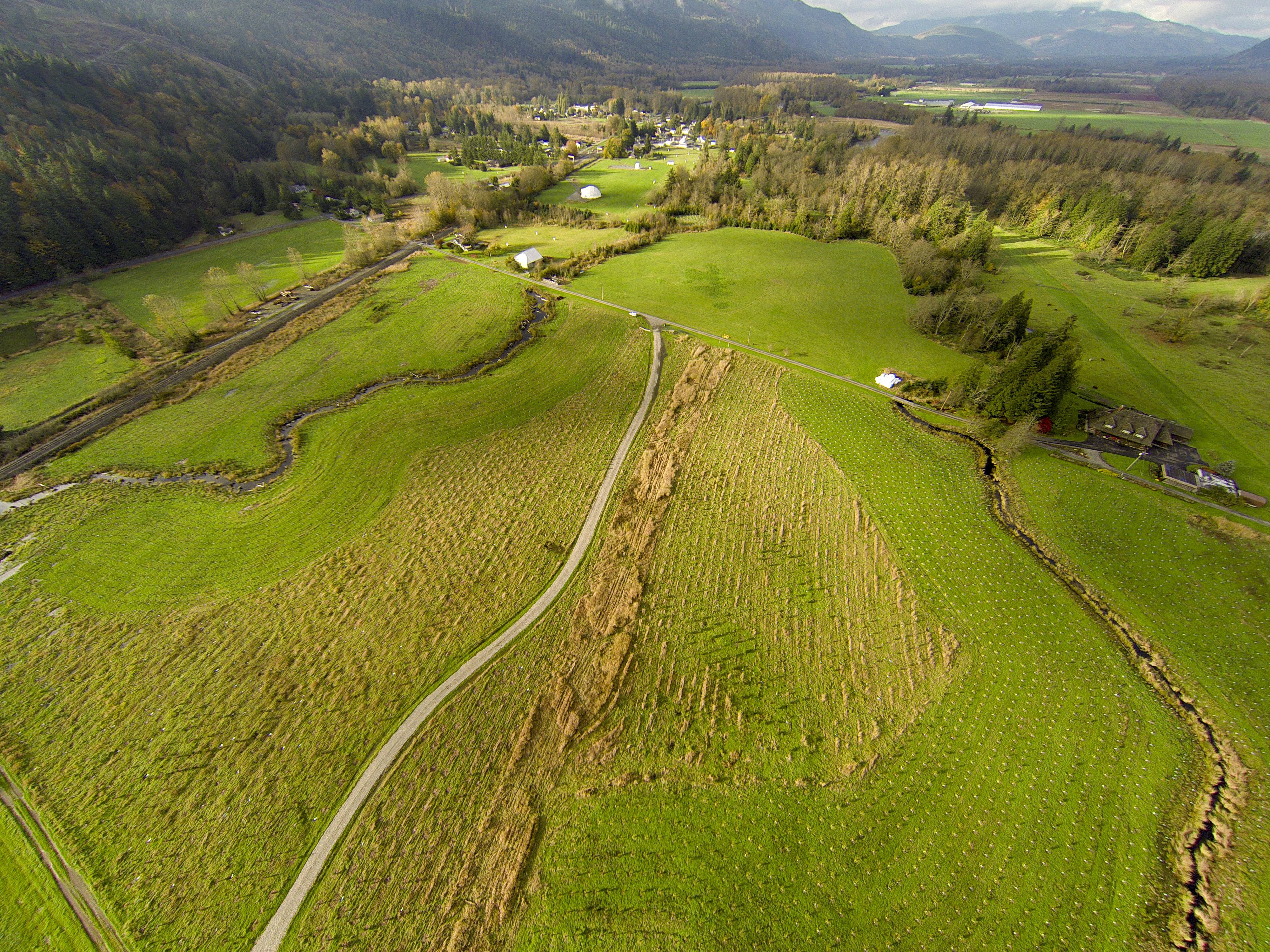
Aerial view of the South Fork Downstream of Hutchinson Phase 2 Project by the Nooksack Indian Tribe on the South Fork of the river.
Nooksack River, South Fork
Aerial view of the South Fork Downstream of Hutchinson Phase 2 Project by the Nooksack Indian Tribe on the South Fork of the river.
Nooksack River, South Fork
We’ve had a very wet winter, with record breaking rain in Bellingham a few days ago. My record of our daily rainfall for CoCoRaHS (Community Collaborative Rain, Hail & Snow Network) shows that we’ve had a total of 15.35 inches since the first of the year and just eleven days without rain.
This video was taken in mid-afternoon on Feb 16, after a particularly juicy 6-day stretch. Our gauge at the foot of Bowman Mountain showed a total of 6.81 inches for this period. There are no CoCoRaHS stations to the east of us but I think it is safe to assume that rainfall was much heavier in the higher elevations above the South Fork.
An editorial post in the Olympian on the benefits of salmon recovery projects:
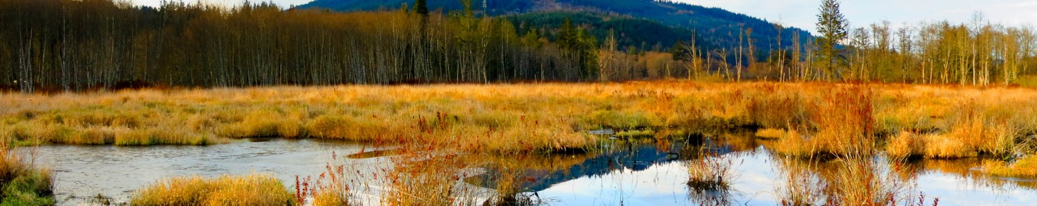
This photograph was taken from the bridge at Wickersham, looking north over the wetlands that form the headwaters of the Samish River. This Whatcom Land Trust wetland extends about 9,500 feet from this bridge to the Doren Road. Photographing a wetland of this size from the air is going to be a challenge — if the UAV goes down for any reason, chances of recovery are close to zero.
But as they say: What could possibly go wrong?
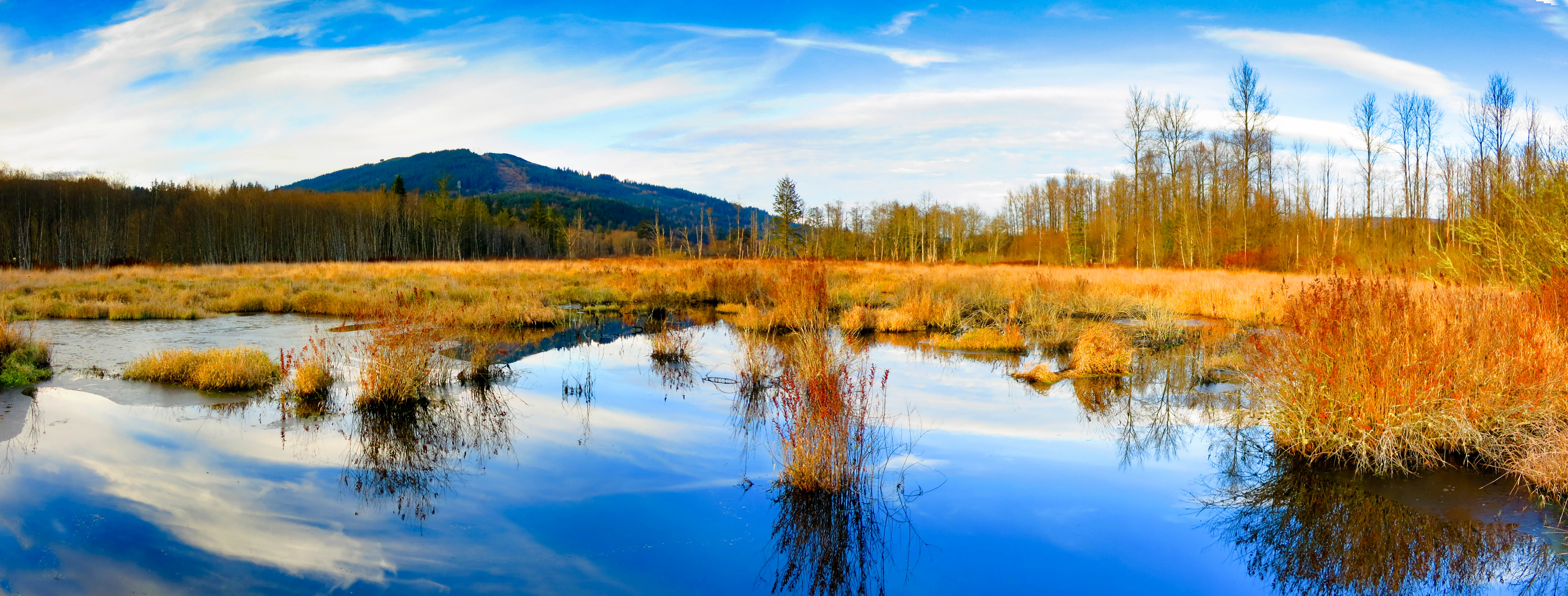
Samish River headwaters
Click the image to see it full-size
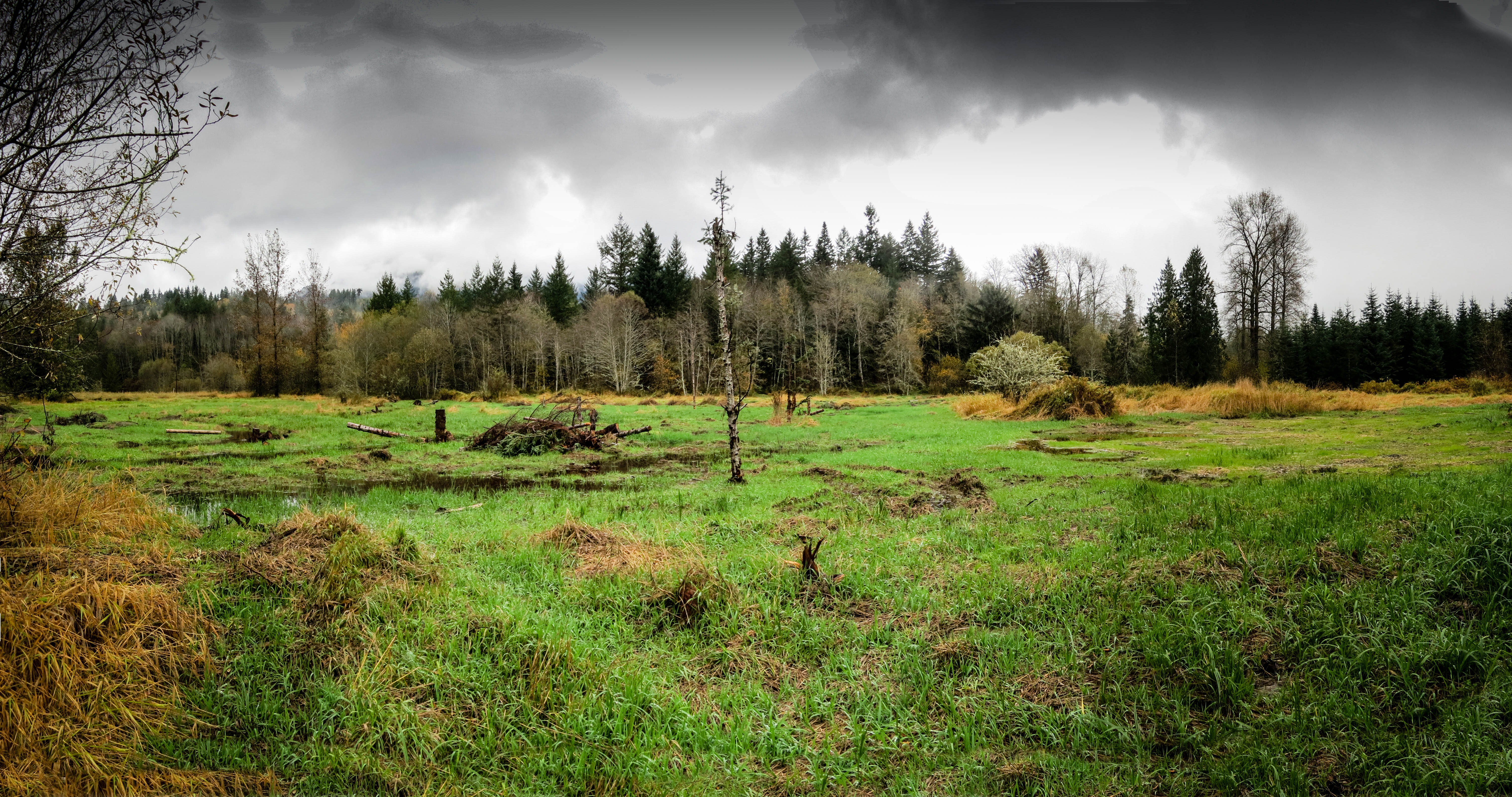
Many people who visit Maple Reach don’t realize how much restoration work has been done at this reserve. When viewed from ground level there’s really not much evidence of the extensive changes that have been done to this former farmland. Unless you view the aerial videos or actually walk through the property, little is actually revealed.
This photograph was taken in late October, shortly after a good dose of rain filled the new stream channels.
October 10, 2014 Contact: Theresa Mitchell, (360) 902-2750 Public comment sought on plan to restore Puget Sound shoreline OLYMPIA – The U.S. Army Corps of Engineers (Army Corps) and the Washington Department of Fish and Wildlife (WDFW) are seeking public … Continue reading
4 November 2014
Aerial video
Landing Strip Creek: a small salmon stream winding through the recently replanted Catalyst Reserve just south of Acme,in Whatcom County, WA.
4 November 2014 overview of the Nooksack Indian Tribe’s project on the South Fork of the Nooksack, at the Catalyst Reserve (Whatcom Land Trust).
< 
Downstream of Hutchinson Phase 2 by Conservation Aerials is licensed under a Creative Commons Attribution-NonCommercial 4.0 International License.>
Catalyst NW Corner